Local government area for Naturi, SA

home > localities > Naturi > local government area for Naturi
bonzle.com logo
Description
General
Weather
FAQ
LGA
Terrain
Map Includes
>>>Contribute
Pictures
Notes
Stories
Submit website

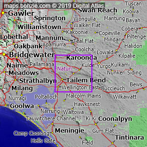
 myBonzle menu: Add to my places   Add picture   Add story   Add note   

Skip to map  

Naturi is in the local government area of 'The Coorong'. The 'The Coorong' local government area is classified as a 'District Council'.

The The Coorong local government area includes around 48 cities, towns, villages and localities including Tailem Bend (pop. around 1,400), Meningie (pop. around 900), Tintinara (pop. around 270), Coonalpyn (pop. around 210), Elwomple, Cooke Plains, Malinong, Malcolm Plains, Wurtun, Waltowa, Wellington East, Nine Mile Turn Off, Hells Gate, Ashville, Camp Coorong, Poltalloch, Younghusband Peninsula, Campbell Park, Narrung and Narwellawar.

A local government area (abbreviated as 'LGA') is an area controlled by a local government. Local government areas can provide a useful way to group statistical information.

If you're interested in Localities then you may also be interested in Suburbs/Regional Areas, Cities, Towns and Villages and Cities, Towns and Villages.

Do you have a photo of Naturi gathering cyber dust on your hard drive?   Why not upload it and share your information with other Bonzle users.   Click here to view recently uploaded photos from other users or browse thousands of pictures grouped by themes in Bonzle collections.   Here are some examples:

Picture relating to Telowie Gorge Conservation Park - titled 'Telowie Gorge Conservation Park'Telowie Gorge Conservation Park Picture relating to Ormiston Gorge - titled 'Ormiston Gorge - dingo eating a fish'Ormiston Gorge Picture relating to Molonglo River - titled 'Where the Molonglo River joins the Murrumbidgee River'Molonglo River Picture relating to Glenmorgan - titled 'Glenmorgan - tank'Glenmorgan

Create a custom map: Click here to create a custom map including 'Naturi'

Link to this page: Click here to see how

Map of Naturi in South Australia
Click on the name of a place to go to the Bonzle page for that place. For other clicks on the map, select what click action you want below, then click on the map where you want that action performed.

ZOOM IN  ZOOM OUT  PAN/MOVE  GET HEIGHT/DEPTH & POSITION

scroll up and leftscroll up and leftscroll upscroll upscroll upscroll up and rightscroll up and right
scroll up and left
scroll up and right
scroll left
scroll left
scroll left
scroll right
scroll right
scroll right
scroll down and leftscroll down and right
scroll down and leftscroll down and leftscroll downscroll downscroll downscroll down and rightscroll down and right
< MAX INCLICK IN THE SHADED BAR BELOW TO SET THE ZOOM LEVELMAX OUT >
zoombar
Map Legend
8km
mapscalemapscalemapscale
5mi
colour of populated areasPopulated Areascolour of sandSand
colour of reserves and parksReserves and Parkscolour of native vegetationNative Vegetation
What's nearby
hide
myBonzlehide
Sign In | Not a member? Join now!
Searchhide
Position within Australiahide
Your locationhide
Places last visitedhide

Naturi in South Australia
Adelaide in South Australia
Tailem Bend in South Australia
Arkaba Creek in South Australia

Your screen sizehide

640 | 800 | 1024 | 1280 | 1400 | 1600

©2024 Digital Atlas Pty Limited | Usage Terms | Data Sources
If you do not agree with the Usage Terms then do not access this website.