Map of Moorilyanna Hill, SA

home > mountains and hills > Moorilyanna Hill > map of Moorilyanna Hill
bonzle.com logo
Description
General
FAQ
LGA
Terrain
Map Includes
>>>Contribute
Pictures
Notes
Stories
Submit website

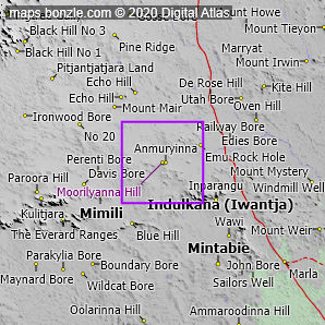
 myBonzle menu: Add to my places   Add picture   Add story   Add note   

Skip to map  

Do you have a picture of 'Moorilyanna Hill'?
Do you have a picture of 'Moorilyanna Hill'? If so, upload it.
Share your Australia - add a picture

Moorilyanna Hill is a hill in northwest South Australia. Moorilyanna Hill is at an altitude of about 561m above sea level.

The nearest towns, villages or cities to Moorilyanna Hill are the village of Indulkana (Iwantja) (30.9km away - show me), the village of Mimili (34.7km away - show me) and the village of Mintabie (57km away - show me).

The nearest road to Moorilyanna Hill is an unsealed road that is un-named in our database and comes within 281m of the summit.

The nearest sealed road to Moorilyanna Hill is the Stuart Highway (31.2km away).

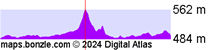
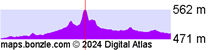
Do you know what facilities are available at Moorilyanna Hill? Contribute your knowledge by clicking here.

Do you know what recreational activities are available at Moorilyanna Hill? Contribute your knowledge by clicking here.

Are you a keen bird watcher? Have you been bird watching at Moorilyanna Hill? What birds have you seen at Moorilyanna Hill? Contribute your knowledge by clicking here. As a Bonzle sub-project, we're trying to build Australia's most comprehensive bird location atlas. A big thankyou to all that have contributed and continue to contribute sightings.

Click here for detailed terrain profiles which show the topography around Moorilyanna Hill.
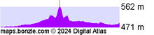
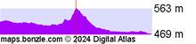

Do you have a photo of Moorilyanna Hill gathering cyber dust on your hard drive?   Why not upload it and share your information with other Bonzle users.   Click here to view recently uploaded photos from other users or browse thousands of pictures grouped by themes in Bonzle collections.   Here are some examples:

Picture relating to Huddleston - titled 'Huddleston'Huddleston Picture relating to Wallaroo Mine - titled 'Wallaroo Mine- Harveys Enginehouse -North Hughes Shaft'Wallaroo Mine Picture relating to Lake Avon - titled 'Lake Avon gardens'Lake Avon Picture relating to Canberra - titled 'Commonwealth Avenue, Hotel Canberra and Albert Hall from West Block.'Canberra

Create a custom map: Click here to create a custom map including 'Moorilyanna Hill'

Link to this page: Click here to see how

Map of Moorilyanna Hill in South Australia
Click on the name of a place to go to the Bonzle page for that place. For other clicks on the map, select what click action you want below, then click on the map where you want that action performed.

ZOOM IN  ZOOM OUT  PAN/MOVE  GET HEIGHT/DEPTH & POSITION

scroll up and leftscroll up and leftscroll upscroll upscroll upscroll up and rightscroll up and right
scroll up and left
scroll up and right
scroll left
scroll left
scroll left
scroll right
scroll right
scroll right
scroll down and leftscroll down and right
scroll down and leftscroll down and leftscroll downscroll downscroll downscroll down and rightscroll down and right
< MAX INCLICK IN THE SHADED BAR BELOW TO SET THE ZOOM LEVELMAX OUT >
zoombar
Map Legend
8km
mapscalemapscalemapscale
5mi
colour of populated areasPopulated Areascolour of sandSand
colour of reserves and parksReserves and Parkscolour of native vegetationNative Vegetation
What's nearby
hide
myBonzlehide
Sign In | Not a member? Join now!
Searchhide
Position within Australiahide
Your locationhide
Places last visitedhide

Naturi in South Australia
Merlynston in Victoria
Karoonda in South Australia
Tailem Bend in South Australia
Moorabinda in Victoria
Meningie in South Australia

Your screen sizehide

640 | 800 | 1024 | 1280 | 1400 | 1600

©2024 Digital Atlas Pty Limited | Usage Terms | Data Sources
If you do not agree with the Usage Terms then do not access this website.