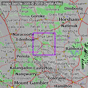
Map of Moorabinda, VIC

home > homesteads > Moorabinda > map of Moorabinda
bonzle.com logo
Description
General
Weather
FAQ
Terrain
Map Includes
>>>Contribute
Pictures
Notes
Stories
Submit website

 myBonzle menu: Add to my places   Add picture   Add story   Add note   

Skip to map  

Do you have a picture of 'Moorabinda'?
Do you have a picture of 'Moorabinda'? If so, upload it.
Share your Australia - add a picture

Moorabinda is located just off the Coleraine Edenhope Road in west Victoria a distance of about 320km west-northwest from Melbourne (show me). Moorabinda is at an altitude of about 173m above sea level. Moorabinda is one of the westernmost homesteads in Victoria. The nearest ocean is the Southern Ocean about 110km south-southwest of Moorabinda.

The nearest more populous place is the village of Edenhope which is 15km away with a population of around 780 (show me a map with Moorabinda and Edenhope).

Do you know what condition Moorabinda is in? Contribute your knowledge by clicking here.

Do you know what facilities are available at Moorabinda? Contribute your knowledge by clicking here.

Are you a keen gardener? Do you know what edible garden plants grow at Moorabinda? Contribute your knowledge by clicking here.

Do you know whether any feral animals, insects and weeds have invaded Moorabinda? Contribute your knowledge by clicking here.

Do you know of any agricultural activities in Moorabinda? Contribute your knowledge by clicking here.

Do you have a photo of Moorabinda gathering cyber dust on your hard drive?   Why not upload it and share your information with other Bonzle users.   Click here to view recently uploaded photos from other users or browse thousands of pictures grouped by themes in Bonzle collections.   Here are some examples:

Picture relating to Lake Macdonald - titled 'Lake McDonald 'Lake Macdonald Picture relating to Parliament House - titled 'English Speaking Union NSW - During tour of Canberra by the NSW branch of the English Speaking Union, on the steps of Old Parliament House.'Parliament House Picture relating to Keep River National Park - titled 'Keep River National Park'Keep River National Park Picture relating to Mount Bischoff Mine - titled 'Mount Bischoff Mine'Mount Bischoff Mine

Not the 'Moorabinda' you were after? Try: Moorabinda (the homestead) near Crookwell in New South Wales; Moorabinda (the homestead) near Taroom in Queensland; or Moorabinda (the homestead) near Texas in New South Wales.

Create a custom map: Click here to create a custom map including 'Moorabinda'

Link to this page: Click here to see how

Map of Moorabinda in Victoria
Click on the name of a place to go to the Bonzle page for that place. For other clicks on the map, select what click action you want below, then click on the map where you want that action performed.

ZOOM IN  ZOOM OUT  PAN/MOVE  GET HEIGHT/DEPTH & POSITION

scroll up and leftscroll up and leftscroll upscroll upscroll upscroll up and rightscroll up and right
scroll up and left
scroll up and right
scroll left
scroll left
scroll left
scroll right
scroll right
scroll right
scroll down and leftscroll down and right
scroll down and leftscroll down and leftscroll downscroll downscroll downscroll down and rightscroll down and right
< MAX INCLICK IN THE SHADED BAR BELOW TO SET THE ZOOM LEVELMAX OUT >
zoombar
Map Legend
8km
mapscalemapscalemapscale
5mi
colour of populated areasPopulated Areascolour of sandSand
colour of reserves and parksReserves and Parkscolour of native vegetationNative Vegetation
What's nearby
hide
myBonzlehide
Sign In | Not a member? Join now!
Searchhide
Position within Australiahide
Your locationhide
Places last visitedhide

Naturi in South Australia
Meningie in South Australia

Your screen sizehide

640 | 800 | 1024 | 1280 | 1400 | 1600

©2024 Digital Atlas Pty Limited | Usage Terms | Data Sources
If you do not agree with the Usage Terms then do not access this website.