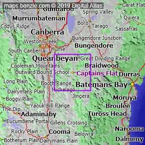
myBonzle menu: Add to my places Add picture Add story Add note Skip to map The map includes: - the village of Captains Flat (pop. around 420).
- a number of mountains and hills including Tinderry Peak (1586m), Tinderry Twin Peak (1558m), Mount Tumanang (1473m), Tumatbulla Mountain (1311m), Mount Bollard (1233m), Mount Palerang (1231m), Round Mount (1230m), Mount Woolpack (1224m), Mount Foxlow (1210m), Mount Bullongong (1190m) and Harrisons Peak (1155m).
- a number of rivers and creeks including the Shoalhaven River, the Molonglo River, the Queanbeyan River, Mulloon Creek, Jerrabattgulla Creek, Ballinafad Creek, Yandyguinula Creek, Bombay Creek, Tinderry Creek and Ballallaba Creek.
- Captains Flat Road and Palerang Fire Trail.
If you're interested in Cities, Towns and Villages then you may also be interested in Suburbs/Regional Areas. |