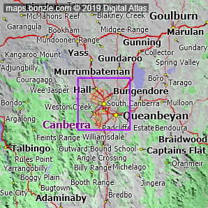
myBonzle menu: Add to my places Add picture Add story Add note Skip to map The map includes: - the following cities, towns and villages Canberra (pop. about 310,000), Queanbeyan (pop. around 30,000), Hall (pop. around 350) and Sutton (pop. around 260).
- a number of mountains and hills including Yarrow Peak (1071m), Mount Elisa (962m), Poppet Hill (914m), Taliesin Hills (894m), Millpost Hill (882m), Mount Majura (880m), Black Hill (860m), One Tree Hill (855m), Mount Taylor (851m), Murrays Hill (851m) and Mount Ainslie (836m).
- a number of rivers and creeks including the Murrumbidgee River, the Yass River, the Molonglo River, the Queanbeyan River, the Cotter River, Brooks Creek, Jerrabomberra Creek, Murrumbateman Creek, the Paddys River and Jeir Creek.
- a number of roads including Monaro Highway, Kings Highway, Federal Highway, Brindabella Road, Barton Highway, Captains Flat Road, Sutton Road, Mountain Creek Road, Bungendore Road and Two Sticks Road.
If you're interested in Cities, Towns and Villages then you may also be interested in Suburbs/Regional Areas. |