Map of Brukunga, SA

home > cities, towns and villages > Brukunga > map of Brukunga
bonzle.com logo
Description
General
Weather
People
FAQ
LGA
Terrain
Similar
Map Includes
>>>Contribute
Pictures
Notes
Stories
Submit website

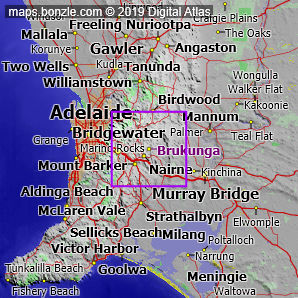
 myBonzle menu: Add to my places   Add picture   Add story   Add note   

Skip to map  

Do you have a picture of 'Brukunga'?
Do you have a picture of 'Brukunga'? If so, upload it.
Share your Australia - add a picture

Brukunga is a village in southeast South Australia, Australia situated 32km east-southeast of Adelaide (show me). Brukunga has a population of around 230 and is one of the smaller towns in Australia. Brukunga is at an altitude of about 356m above sea level.

The nearest more populous place is the town of Nairne which is 4.7km away with a population of around 2,800 (show me a map with Brukunga and Nairne).

Bonzle users have said that the facilities at Brukunga include a fire station, high school and medical centre. Do you know of other facilities available at Brukunga? Is this list accurate? Contribute your knowledge by clicking here.

Are you a keen gardener? Do you know what edible garden plants grow at Brukunga? Contribute your knowledge by clicking here.

Do you know whether any feral animals, insects and weeds have invaded Brukunga? Contribute your knowledge by clicking here.

Do you know of any agricultural activities in Brukunga? Contribute your knowledge by clicking here.

If you're interested in Cities, Towns and Villages then you may also be interested in Suburbs/Regional Areas.

Do you have a photo of Brukunga gathering cyber dust on your hard drive?   Why not upload it and share your information with other Bonzle users.   Click here to view recently uploaded photos from other users or browse thousands of pictures grouped by themes in Bonzle collections.   Here are some examples:

Picture relating to Brighton - titled 'Brighton'Brighton Picture relating to Canberra - titled 'View of Canberra Golf Links'Canberra Picture relating to East Melbourne - titled 'Stadium roof in East Melbourne.'East Melbourne Picture relating to Argyle Mine - titled 'Argyle Mine'Argyle Mine

Not the 'Brukunga' you were after? Try the other Brukunga (the regional area) in South Australia.

Create a custom map: Click here to create a custom map including 'Brukunga'

Link to this page: Click here to see how

Map of Brukunga in South Australia
Click on the name of a place to go to the Bonzle page for that place. For other clicks on the map, select what click action you want below, then click on the map where you want that action performed.

ZOOM IN  ZOOM OUT  PAN/MOVE  GET HEIGHT/DEPTH & POSITION

scroll up and leftscroll up and leftscroll upscroll upscroll upscroll up and rightscroll up and right
scroll up and left
scroll up and right
scroll left
scroll left
scroll left
scroll right
scroll right
scroll right
scroll down and leftscroll down and right
scroll down and leftscroll down and leftscroll downscroll downscroll downscroll down and rightscroll down and right
< MAX INCLICK IN THE SHADED BAR BELOW TO SET THE ZOOM LEVELMAX OUT >
zoombar
Map Legend
8km
mapscalemapscalemapscale
5mi
colour of populated areasPopulated Areascolour of sandSand
colour of reserves and parksReserves and Parkscolour of native vegetationNative Vegetation
What's nearby
hide
myBonzlehide
Sign In | Not a member? Join now!
Searchhide
Position within Australiahide
Your locationhide
Places last visitedhide

Milang in South Australia
Naturi in South Australia
Moorindoorah in Queensland
Strathalbyn in South Australia
Karoonda Road in South Australia
Menincourt in New South Wales
Mount Merragunegin in Victoria
Moorilyanna Hill in South Australia
Merlynston in Victoria

Your screen sizehide

640 | 800 | 1024 | 1280 | 1400 | 1600

©2024 Digital Atlas Pty Limited | Usage Terms | Data Sources
If you do not agree with the Usage Terms then do not access this website.